


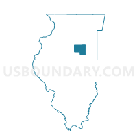
PIKE Voting District, Livingston County, Illinois
About
Outline

Summary
| Unique Area Identifier | 572647 |
| Name | PIKE Voting District |
| County | Livingston County |
| State | Illinois |
| Area (square miles) | 36.41 |
| Land Area (square miles) | 36.36 |
| Water Area (square miles) | 0.05 |
| % of Land Area | 99.87 |
| % of Water Area | 0.13 |
| Latitude of the Internal Point | 40.79205520 |
| Longtitude of the Internal Point | -88.76659870 |
Maps


Graphs
Select a template below for downloading or customizing gragh for PIKE Voting District, Livingston County, Illinois


Neighbors
Neighoring Voting District (by Name) Neighboring Voting District on the Map
- CHENOA 2 Voting District, McLean County, IL
- EPPARDS POINT Voting District, Livingston County, IL
- GRIDLEY 1 Voting District, McLean County, IL
- NEBRASKA 2 Voting District, Livingston County, IL
- PONTIAC 10 Voting District, Livingston County, IL
- ROOKS CREEK Voting District, Livingston County, IL
- WALDO Voting District, Livingston County, IL
- YATES Voting District, McLean County, IL
Top 10 Neighboring County Subdivision (by Population) Neighboring County Subdivision on the Map
- Pontiac township, Livingston County, IL (13,049)
- Chenoa township, McLean County, IL (2,074)
- Gridley township, McLean County, IL (1,913)
- Nebraska township, Livingston County, IL (1,433)
- Rooks Creek township, Livingston County, IL (567)
- Eppards Point township, Livingston County, IL (427)
- Yates township, McLean County, IL (287)
- Waldo township, Livingston County, IL (255)
- Pike township, Livingston County, IL (240)
Top 10 Neighboring Place (by Population) Neighboring Place on the Map
Top 10 Neighboring Elementary School District (by Population) Neighboring Elementary School District on the Map
- Pontiac Community Consolidated School District 429, IL (13,716)
- Rooks Creek Community Consolidated School District 425, IL (546)
Top 10 Neighboring Secondary School District (by Population) Neighboring Secondary School District on the Map
Top 10 Neighboring Unified School District (by Population) Neighboring Unified School District on the Map
- Prairie Central Community Unit School District 8, IL (11,294)
- El Paso-Gridley Community Unit School District 11, IL (7,019)
- Flanagan-Cornell District 74, IL (1,689)
Top 10 Neighboring State Legislative District Lower Chamber (by Population) Neighboring State Legislative District Lower Chamber on the Map
Top 10 Neighboring State Legislative District Upper Chamber (by Population) Neighboring State Legislative District Upper Chamber on the Map
Top 10 Neighboring 111th Congressional District (by Population) Neighboring 111th Congressional District on the Map
Top 10 Neighboring Census Tract (by Population) Neighboring Census Tract on the Map
- Census Tract 51.02, McLean County, IL (6,749)
- Census Tract 9608, Livingston County, IL (5,731)
- Census Tract 57, McLean County, IL (5,144)
- Census Tract 9604, Livingston County, IL (3,430)